• Latest
Topographical data: Unprecedented insight into Grenada’s terrestrial and coastal landscapes

Topographical data: Unprecedented insight into Grenada’s terrestrial and coastal landscapes

8 years ago

IMA Grenada career opportunity: Accounts Manager

1 day ago
Parliamentary Elections Office staff to participate in retreat

Grenada hosts high-level Canada–India Trade and Investment Mission

2 days ago
Traffic Arrangements – Mt Gay/La Mode Public Road, St George

Traffic Arrangements – Mt Gay/La Mode Public Road, St George

2 days ago
Grenada Transport Commission invests in public transport sector

Ministry of Transportation updates on public transport support initiatives

2 days ago
Government committed to supporting regional air transportation

Government advances Passenger Information and Passenger Name Record Bill, 2026

2 days ago
Special Education Needs to enhance education sector

Beyond Sustainability: OECS launches communications campaign

2 days ago
Ministry of Education actively resolving teacher salary delays 

Ministry of Education actively resolving teacher salary delays 

2 days ago
OECS Health Ministers To Develop Virus Strategy

Ebola Bundibugyo Virus Disease outbreak in Central and East Africa

3 days ago
Minister Andrews tours major infrastructure projects across Carriacou

Minister Andrews tours major infrastructure projects across Carriacou

3 days ago
GNSA and GSWMA celebrate Blaze the Track – Smash the Trash Competition winners

GNSA and GSWMA celebrate Blaze the Track – Smash the Trash Competition winners

3 days ago
Claims of coronavirus at SGU designed to create fear and panic

Vacancy: Chief Financial Officer, Grenada Hospital System

3 days ago
Blue Economy value chain groups invited to virtual information sessions

Blue Economy value chain groups invited to virtual information sessions

3 days ago
NOW Grenada
  • Front Page
  • Categories
    • General News
      • All
      • Agriculture & Fisheries
      • Arts & Culture
      • Business
      • Education
      • Environment
      • Health
      • History
      • Lifestyle
      • Law
      • Politics
      • Technology
      • Travel & Tourism
      • Weather
      • Youth
    • Sports
      • All
      • Athletics
      • Cricket
      • Football
      • Watersports
    • Community
      • All
      • Tribute
    • Crime
    • Features
      • All
      • Today in History
    • Opinion/Commentary
    • Press Releases
      • All
      • Advertisements
      • Notices
  • Video
  • Notices & Vacancies
  • Advertise
  • Contact Us
No Result
View All Result
NOW Grenada
No Result
View All Result

Topographical data: Unprecedented insight into Grenada’s terrestrial and coastal landscapes

This story was posted 8 years ago
28 June 2018
in Agriculture/Fisheries, Environment, Technology
4 min. read
Minister Yolande Bain Horsford receiving the LiDAR topographical and Bathymetric data from the French firm Fugro
0
VIEWS
Share

by Curlan Campbell, NOW Grenada

  • Fugro hands over topographical and bathymetric data to government
  • Survey part of Caribbean Climate Resilience and Disaster Vulnerability Reduction Project

Unique topographical and bathymetric data provides unprecedented insight into Grenada’s terrestrial and coastal landscapes which in turn provides government with a wealth of information that they can be used to implement disaster risk mitigation strategies.

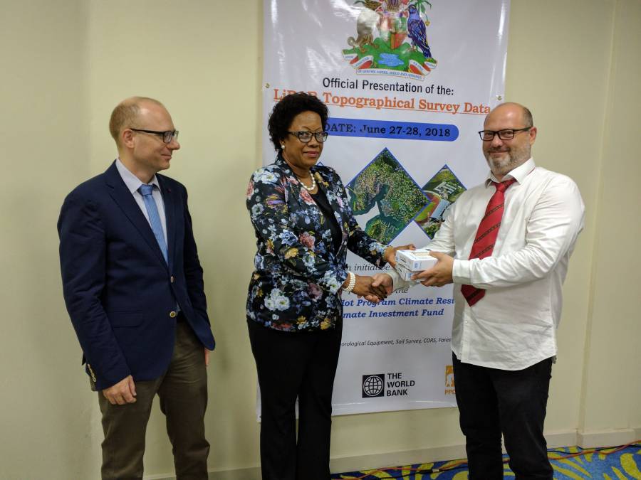
After nearly 8 months of collecting topographical and bathymetric data of Grenada, Carriacou, and Petite Martinique the data was officially handed over to the Government of Grenada by the firm Fugro of France which was chosen by the government to conduct the survey using LiDAR technology.

The most relevant natural hazard risks in Grenada are landslides, flooding, soil erosion tsunami or rise in sea level. In the process of qualifying these risks and their impact and the subsequent implementation of mitigating measures, analyses of the existing terrain, land use, and infrastructure play an important role.

In November 2017, citizens were notified that a helicopter would be flying over the islands of Grenada, Carriacou and Petite Martinique at an approximate height of 1,804 feet (550 meters), to facilitate the conduct of the LiDAR topographical and bathymetric survey. This project was launched in 2016 as part of the World Bank supported Caribbean Regional Pilot Programme for Climate Resilience and Disaster Vulnerability Reduction Project funded by the World Bank and the Climate Investment Fund.

LiDAR technology is used to capture high resolution accurate and up to date geographical images from above which will then be used to develop topographical maps, depth of coastal waters, vegetation type, land use, cadastral data as well as to develop a survey map of Grenada.

Cross section of stakeholders witnessing the handing over of LiDAR topographical and bathymetric data

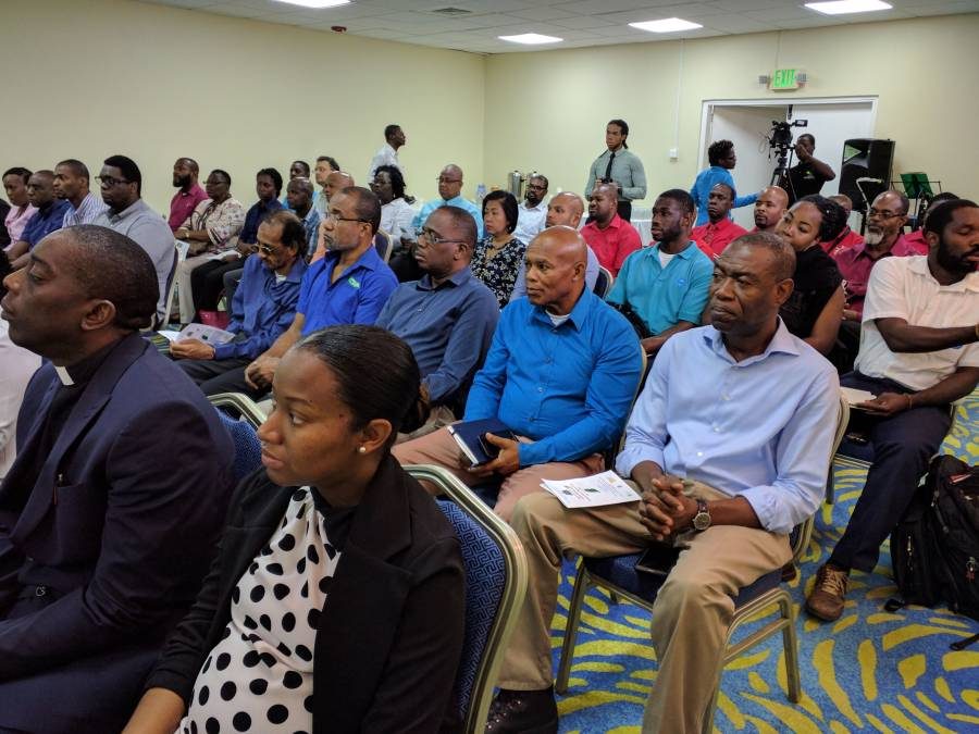
On Wednesday, 27 June 2018 the firm handed over the result of the survey to the Minister for Agriculture Hon. Yolande Bain Horsford during a ceremony held at the Radisson Beach Resort.

LiDAR Consultant Stephan Landtwing says a number of sectors stand to benefit from this data. The first being agricultural sector. “The survey led to an inventory of canopy/vegetation model which tells us where the vegetation is and how high or maybe even the species we are looking to protect. The infrared aerial photography is a very important tool vegetation specialist to determine plant health. If we combine that with the canopy height model, maybe ground samples and soil information, we can go as far as to build complete species inventory, but this is not an automatic process. Even though we have a lot of high-resolution data available, it stills needs a lot of expert input to get there but at the end of the day the end goal is to ensure that the crops are planted in certain areas ideally suited for that area and that they are healthy.”

Another sector which stands to benefit from this data is the area of physical planning. “In order to design these beautiful physical infrastructure scenarios, you’ll need very accurate information about what is the foundation on which we built these infrastructure scenarios on and for this, the LiDAR imagery data are the ideal starting point as this semiautomatic process can produce 3D building models that can be textured using aerial photographs and can be used for planning purposes.”

Landtwing says the survey can calculate the solar energy potential of every rooftop across the tri-island state. “Based on the information from this dataset we can determine the potential and suitability of every household for solar energy, so if a project is started to decrease the country’s reliance on fossil fuels, you can use this dataset to identify the roofs that are most suitable and has the highest efficiency for generating photovoltaic power. We can also see that LiDAR data — this 3-dimensional data — is actually capable of capturing these utility cables and vegetation and in combination we can identify areas where vegetation has encroached on power lines.”

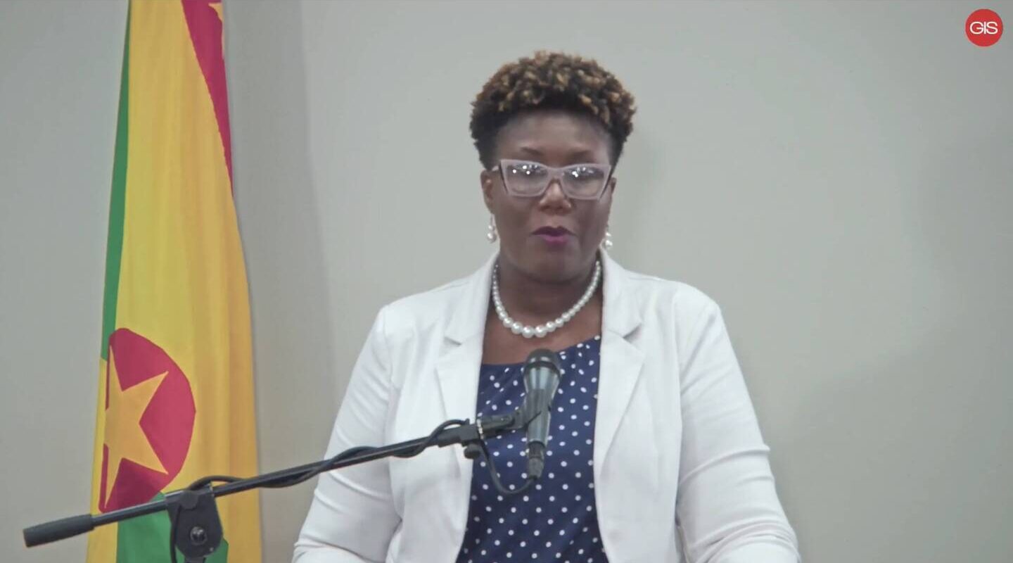
Minister Bain Horsford thanked the firm for their assistance stating that Grenada is now well poised towards building Grenada climate change resistance resolve. “This data will provide the agriculture sector and by extension the entire state of Grenada with the relevant knowledge to be proactive in our mitigation efforts as we confront the reality of climate change. The availability of more accurate information augurs well for reliable planning, risk evaluation, maintenance of infrastructure, optimisation of land use and marine science study.”

Minister Bain Horsford outlined the next step in utilising the data presented. “We will entrust the government agency with the responsibility of securing and managing the data, after which we will implement a data sharing policy for government and nongovernment agencies and technical interface to assess the data in a seamless and efficient manner and finally, we will develop and execute an awareness program which will allow end users to realise the potential benefit of using data in their work.”

The project was managed by Grenada’s DVRP project Coordination Unit (PCU). A technical working group was established under the leadership of the Ministry of Agriculture’s Land Use Division, comprising of representatives from key government and private sector entities that stand to benefit from updated high-resolution geographical data.

NOW Grenada is not responsible for the opinions, statements or media content presented by contributors. In case of abuse, click here to report.
Tags: curlan campbelllidar technologyministry of agricultureregional disaster vulnerability reduction project

© NOW Grenada Ltd. All Rights Reserved. Terms of Use | Privacy Policy

No Result
View All Result
  • Front Page
  • Categories
    • General News
      • All
      • Agriculture & Fisheries
      • Arts & Culture
      • Business
      • Education
      • Environment
      • Health
      • History
      • Lifestyle
      • Law
      • Politics
      • Technology
      • Travel & Tourism
      • Weather
      • Youth
    • Sports
      • All
      • Athletics
      • Cricket
      • Football
      • Watersports
    • Community
      • All
      • Tribute
    • Crime
    • Features
      • All
      • Today in History
    • Opinion/Commentary
    • Press Releases
      • All
      • Advertisements
      • Notices
  • Video
  • Notices & Vacancies
  • Advertise
  • Contact Us

Copyright NOW Grenada

We are using cookies to give you the best experience on our website.

You can find out more about which cookies we are using or switch them off in . Visit our Privacy Policy | Terms of Use.

No Result
View All Result
  • Front Page
  • Categories
    • General News
      • All
      • Agriculture & Fisheries
      • Arts & Culture
      • Business
      • Education
      • Environment
      • Health
      • History
      • Lifestyle
      • Law
      • Politics
      • Technology
      • Travel & Tourism
      • Weather
      • Youth
    • Sports
      • All
      • Athletics
      • Cricket
      • Football
      • Watersports
    • Community
      • All
      • Tribute
    • Crime
    • Features
      • All
      • Today in History
    • Opinion/Commentary
    • Press Releases
      • All
      • Advertisements
      • Notices
  • Video
  • Notices & Vacancies
  • Advertise
  • Contact Us

Copyright NOW Grenada

Powered by  GDPR Cookie Compliance
Privacy Overview

This website uses cookies so that we can provide you with the best user experience possible. Cookie information is stored in your browser and performs functions such as recognising you when you return to our website and helping our team to understand which sections of the website you find most interesting and useful. Visit our Privacy Policy | Terms of Use.

Strictly Necessary Cookies

Strictly Necessary Cookie should be enabled at all times so that we can save your preferences for cookie settings.