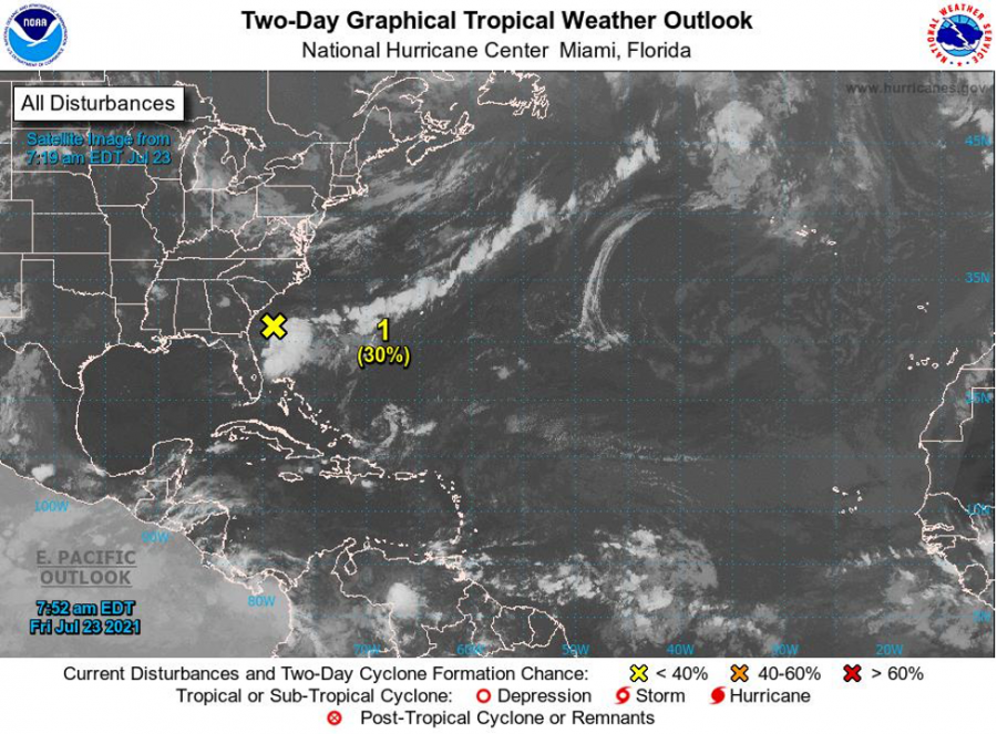


For Tropical North Atlantic Ocean, Caribbean Sea and Gulf of Mexico: Area of Special Interest: 10–20°N And 45–65°W
- Tropical wave: An Atlantic tropical wave extends its axis along 54° W south of 18° N, 563nm east of Grenada, moving west near 15 to 20 kt. Scattered moderate convection is evident along the ITCZ south of 12N between 40° W and 53° W. A broad area of Saharan Air accompanies this wave, extending from 12° N to 24° N from 60° W to beyond 40° W. An increase in cloudiness along with light to moderate showers, and a medium chance of thunder can be expected on Friday night into Saturday morning as a result of this wave.
- Trough: A trough of low pressure is located just offshore of the southeastern United States coastline. Shower and thunderstorm activity has increased this morning, and environmental conditions appear marginally conducive for some additional development during the next couple of days while the system drifts offshore of the southeastern United States. This system has a low chance, (30%) of becoming a tropical cyclone within the next 48 hours, and a low chance, (30%) of becoming a tropical cyclone within the next 5 days. This system poses no threat to the State of Grenada.

Elsewhere, tropical cyclone formation is not expected during the next 2 days.
The next update will be issued at 2 pm.
Eugine Whint, Duty Forecaster
NOW Grenada is not responsible for the opinions, statements or media content presented by contributors. In case of abuse, click here to report.