


For Tropical North Atlantic Ocean, Caribbean Sea and Gulf of Mexico: Area of Special Interest: 10–20°N And 45–65°W
- Tropical wave: An Atlantic tropical wave is along 47° W from 13° N southward and moving W at 15 to 20 kt. Scattered moderate to isolated strong convection is noted from 07°N to 10°N between 50°W and 53°W, ahead of the wave axis. Based on the wave’s forward speed, the wave axis is expected to traverse the Windward Islands on Wednesday night.
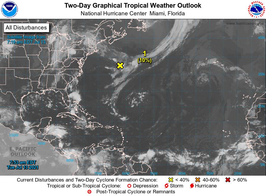
- Low Pressure area: A non-tropical broad area of low pressure has formed along a decaying frontal boundary several hundred miles south-southeast of Cape Race, Newfoundland. The low is producing a concentrated area of showers and thunderstorms over the eastern portion of the system. Although environmental conditions are only marginally favourable at this time, some slight development is possible during the next couple of days as it drifts generally southward over warmer waters. Formation chance through 48 hours, low, 10%. Formation chance through 5 days, low, 10%. This system poses no threat to the State of Grenada.

The Meteorological Service will continue to monitor these systems and provide updates in a timely manner.
Elsewhere, tropical cyclone formation is not expected during the next 2 days.
The next update will be issued at 2 pm.
Eugine Whint, Duty Forecaster
NOW Grenada is not responsible for the opinions, statements or media content presented by contributors. In case of abuse, click here to report.