


The Grenada Meteorological Service is currently monitoring the development and movement of Potential Tropical Cyclone #2.

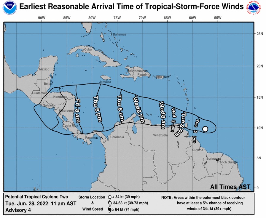
Synopsis: At 11 am AST (1500 UTC), the disturbance was centred near latitude 9.8°North, longitude 57.5°West or about 280 miles east southeast of Grenada. The system is moving toward the west near 23 mph (37 km/h). A westward or west-northwestward motion is expected through Thursday. On the forecast track, the system will pass near or over portions of the southern Windward Islands by tonight, and move over the southern Caribbean Sea or near the northern coast of Venezuela on Wednesday and Thursday.
Projected track: On the forecast track, the system will pass near or over Grenada and portions of the southern Windward Islands by late Tuesday and move over the southern Caribbean Sea or near the northern coast of Venezuela on Wednesday and Thursday.
Forecast for the State of Grenada: Grenada, Carriacou and Petite Martinique can expect cloudy to overcast conditions with moderate to heavy scattered showers, thundershowers and gusty winds on Tuesday night with these conditions continuing into Wednesday morning.
The Met Office continues to closely monitor the progress of this system as it propagates toward Grenada.
Potential Impacts:
- Flooding and flash flooding
- Landslides and rock fall
- Broken tree branches and displacement of loose objects
- Rough waves up to 13 feet
Watches/ Warnings:
A Tropical Storm warning has been issued for Grenada and its dependencies and Trinidad and Tobago.
Next update will be issued at 2 pm or as warranted.
Gerard Tamar, Duty Forecaster


Wishing that God will intervene and protect Grenada tri Island and other islands, T&T and the ABC’s