


For Tropical North Atlantic Ocean, Caribbean Sea and Gulf of Mexico

AREA OF SPECIAL INTEREST: 10 – 20 °N AND 45 – 65 °W
Shear line:
A shear line is embedded in a surge of moisture and instability to the immediate east of the southeast Caribbean. Cloudy conditions and showery activity are observed near Barbados. These conditions are expected to move over Grenada early Monday morning. Winds may become gusty especially with showers. Seas are expected to be 5 to 7 feet in open water; hence, the Meteorological Office has a small craft advisory in effect! Model guidance also signals the potential for some cloudy periods and scattered showers on Monday morning and night, should environmental conditions remain favourable.
Tropical Wave # 1:
A central Atlantic tropical wave extends along 46°W, from 03°N to 21°N, approximately 921 nautical miles east of Grenada. It is moving west at 15 knots. Scattered moderate convection is observed from 09°N to 12°N, between 39°W and 47°W. Based on its forward speed and model guidance, the axis of this wave is expected to traverse the Lesser Antilles on Wednesday. This wave can bring showery activity to Grenada with a low chance of thundershowers if environmental conditions remain favourable.
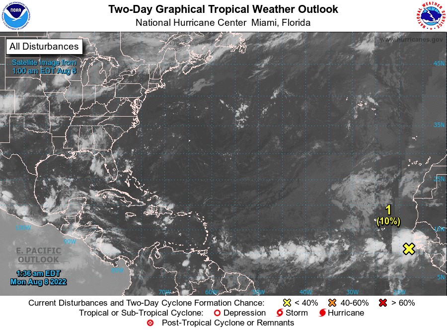
Disturbance 1:
A large area of disorganised showers and thunderstorms over the far eastern tropical Atlantic are associated with a tropical wave. Environmental conditions appear generally conducive for gradual development of this system while it moves westward to west-northwestward at 13 to 17 knots across the eastern and central tropical Atlantic, and a tropical depression could form around the middle to latter part of this week. This system has a low chance, 10%, of becoming a tropical cyclone within the next 48 hours.
The Meteorological Service will continue to monitor the progress of these systems and provide updates in a timely manner.
Elsewhere, tropical cyclone formation is not expected during the next 2 days.
The next update will be issued at 8 am.
Fimber Frank, Duty Forecaster