


For Tropical North Atlantic Ocean, Caribbean Sea and Gulf of Mexico

AREA OF SPECIAL INTEREST: 10 – 20 °N AND 45 – 65 °W
Shear Line:
A shear line with band of moisture and instability is trailing an Eastern Caribbean Sea tropical wave which traversed the island chain earlier this morning. Scattered moderate convection is observed from 14°N to 22°N and between 64°W and 72°W. This convection is capable of bringing localized heavy rainfall, gusty winds and rough seas across the eastern Greater Antilles and SE Bahamas today. This feature continues to support cloudiness and showers/ thundershowers across the Leeward Islands and northern windward Islands.
While Grenada remains on the southern fringes, outside of the zone of active weather, there is a medium chance (40%) of isolated, light to moderate showers and a low (10%) chance of lightning and thunder across the northern sector of the State of Grenada. Winds may become gusty overnight and seas are projected to be moderate to slightly rough with waves 5 feet to 7 feet in N’ly to NE’ly swells; hence the Meteorological Office has a small craft advisory in effect!
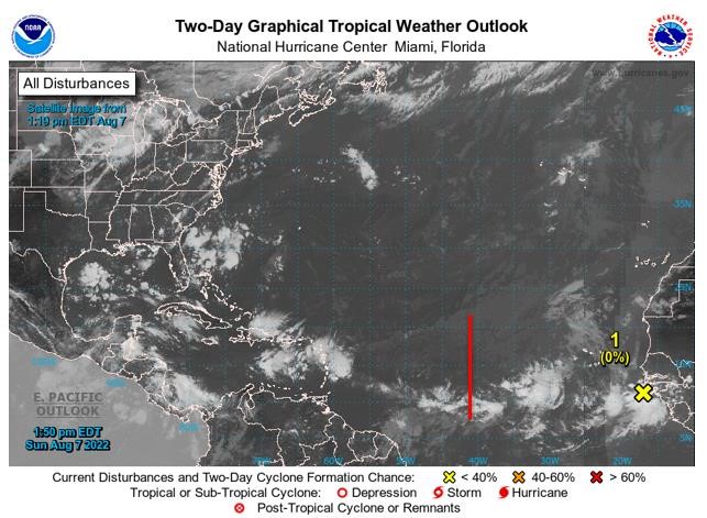
Tropical Wave #1
A central Atlantic tropical wave has its axis along 42°W, extending south of 23°N, 1142 nautical miles (nm) east of Grenada. It is moving westward at 15 kt to 20kt. Scattered showers are noted in the vicinity of where the wave intercepts the monsoon trough near 11°N 42°W. Dry and stable Saharan dust envelops the wave N of 11°N, suppressing the development of showers and thunderstorms. Based on its forward speed and model projections, the axis of this wave should traverse the island chain on Wednesday inducing cloudiness with a medium chance of light to moderate showers and a low chance of lightning and thunder if environmental conditions remain favourable.
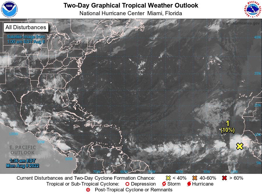
Disturbance 1
A tropical wave located near the west coast of Africa is producing disorganised showers and thunderstorms over the far eastern tropical Atlantic. Environmental conditions appear generally conducive for gradual development of this system while it moves westward to west-northwestward at 15kt to 20 kt across the eastern and central tropical Atlantic, and a tropical depression could form around the middle to the latter part of this week. There is a low (near 0%) formation chance during the next 2 days and a medium (40%) chance within the next 5 days.
The Meteorological Service will continue to monitor the progress of these systems and provide updates in a timely manner.
Elsewhere, tropical cyclone formation is not expected during the next 2 days.
The next update will be issued at 8 pm.
Cécil Mitchell, Duty Forecaster