


For Tropical North Atlantic Ocean, Caribbean Sea and Gulf of Mexico

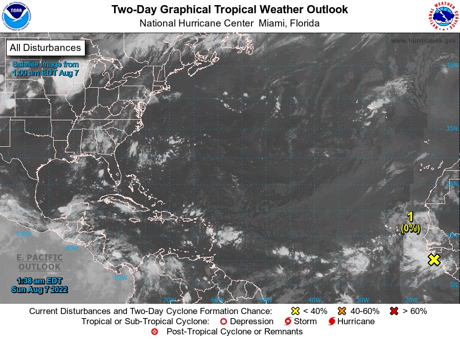
AREA OF SPECIAL INTEREST: 10 – 20 °N AND 45 – 65 °W
- An Atlantic tropical wave has its axis along 40°W or about 1247miles east of Grenada moving westward at 15-20 kt. This wave is moving a through very stable atmospheric environment. Only isolated showers and thunderstorms are seen within 120 nm east of the wave from 06°N to 10°
- An eastern Caribbean Sea tropical wave has its axis along 64°W or 135miles west of Grenada. It is moving westward at 20 kt. Scattered moderate convection behind this wave has decreased in coverage during the past few hours. Satellite imagery shows the convection bounded from 13°N to 16°N and between 55°W and 62° This convection is capable of bringing localised heavy rainfall and gusty winds to sections of the central Lesser Antilles through the rest of the morning. Rough seas can result from the gusty winds.
- A tropical wave located just off the west coast of Africa is producing disorganised showers and thunderstorms over the far eastern tropical Atlantic. Environmental conditions appear generally conducive for gradual development of this system while it moves westward to west-northwestward at 15 to 20 mph across the eastern and central tropical Atlantic, and a tropical depression could form around the middle part of this week. Formation chance through 48 hours…low…near 0%. Formation chance through 5 days…medium…40%.
Tropical cyclone formation is not expected during the next 2 days.
The next update will be issued at 2 pm.
Gerard Tamar, Duty Forecaster
NOW Grenada is not responsible for the opinions, statements or media content presented by contributors. In case of abuse, click here to report.