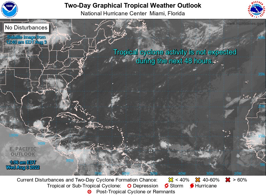


For Tropical North Atlantic Ocean, Caribbean Sea and Gulf of Mexico

AREA OF SPECIAL INTEREST: 10 – 20 °N AND 45 – 65 °W
Low-level trough system:
A low-level trough system has its axis along 60°West, approximately 30 nautical miles (nm) east of Grenada. It is embedded in the ITCZ and supports moist, unstable conditions. Parts of the ITCZ continue from 10°N 53°W to 10° N61°W. This is just to the south of Grenada, near Trinidad and Tobago.
Scattered moderate convection is noted within along either side of the ITCZ. Currently, this system is advecting moisture northward towards the southern Windward Islands from the general area of Trinidad and Tobago allowing for cloudy conditions and scattered showers across the State of Grenada during the nighttime. There is also a medium chance of lightning, thunder, and gusty winds especially overnight.
Therefore, the Meteorological Office has issued warnings for a low chance of flooding and landslides in vulnerable areas and for agitated seas with above normal Northeasterly swells.
Tropical Wave:
A central Atlantic tropical wave has its axis near 51/52°West, extending from 20°North southward, 687 nautical miles (nm) east of Grenada. It is moving westward at 10 kt. Isolated moderate convection is observed near its axis, south of 13°N. At its current speed, the axis of this wave should be over Grenada on Thursday evening/night. More information will be provided at 8 pm tonight.
The Meteorological Service will continue to monitor the progress of these systems and provide updates in a timely manner.
Elsewhere, tropical cyclone formation is not expected during the next 2 days.
The next update will be issued at 8 pm.
Eugine Whint, Duty Forecaster